
Waynesboro ZIP Code Coverage
Official sources examined for Waynesboro establish one ZIP for standard street-address use: 22980. It is the postal ZIP associated with Waynesboro, not a legal outline of the independent city. The City of Waynesboro's tax locality mailing information also uses 22980, which is useful corroboration when checking a city office address. No second ZIP serving a Waynesboro street address was confirmed in the official sources reviewed. A postal result should remain the deciding source for a specific address.
| Postal ZIP | Verified local use | Official service point | Record caution |
|---|---|---|---|
| 22980 | Standard street addresses in the Waynesboro postal city | Main Post Office, 200 S Wayne Ave; Park station, 422 N Commerce Ave | Postal-city coverage is not the independent-city boundary. Confirm a specific address with USPS. |
Both postal service points use 22980, while their facility ZIP+4 suffixes differ. The official Waynesboro Post Office record lists the Main Post Office at 200 South Wayne Avenue as 22980-9998. Those added digits route mail to a facility route. They do not create another public ZIP code or a separate neighborhood.
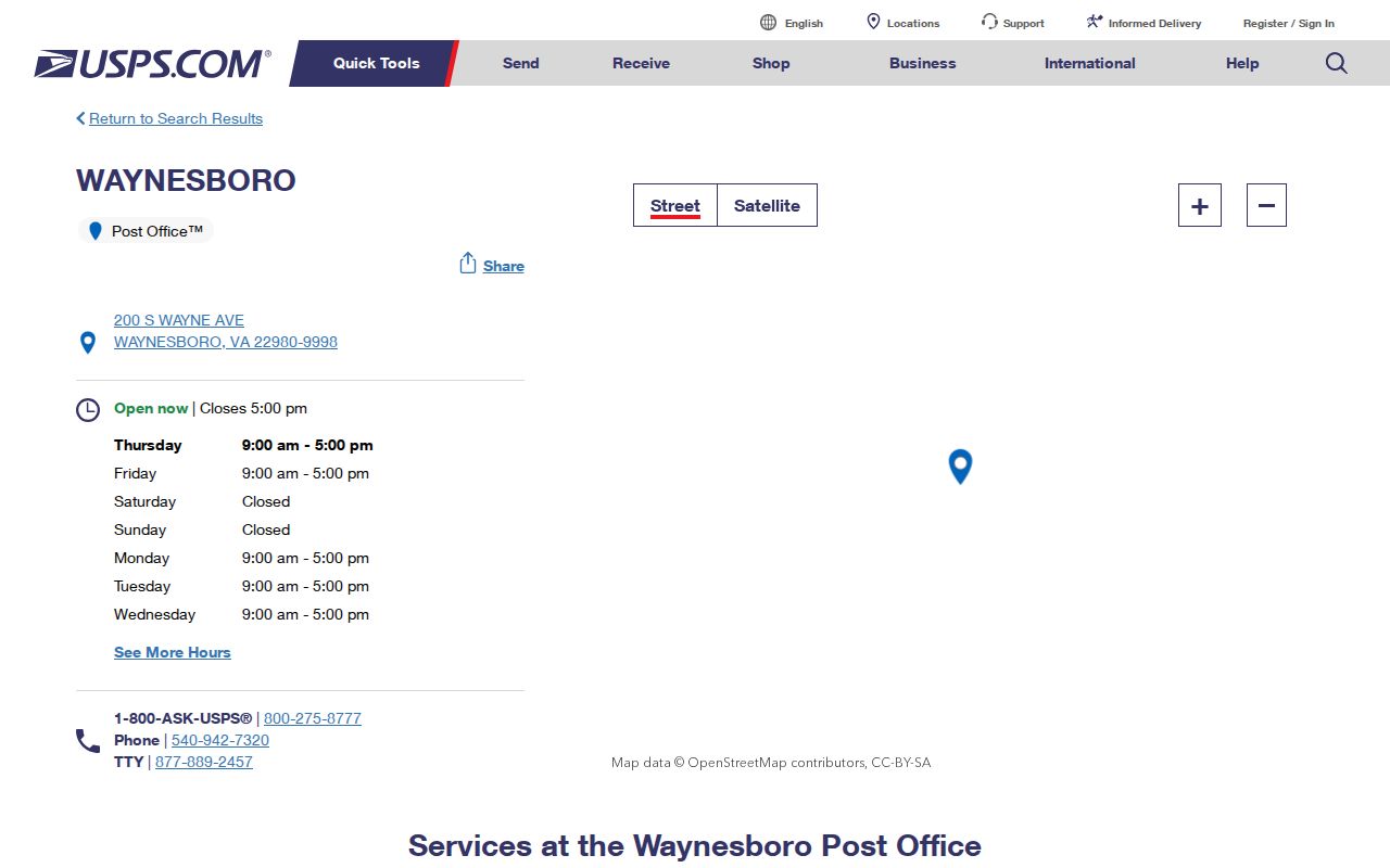
The post-office record gives the postal service point behind the Waynesboro ZIP code directory entry, while the street-address lookup remains the proper check for an individual delivery address.
Waynesboro ZIP Code Search Modes
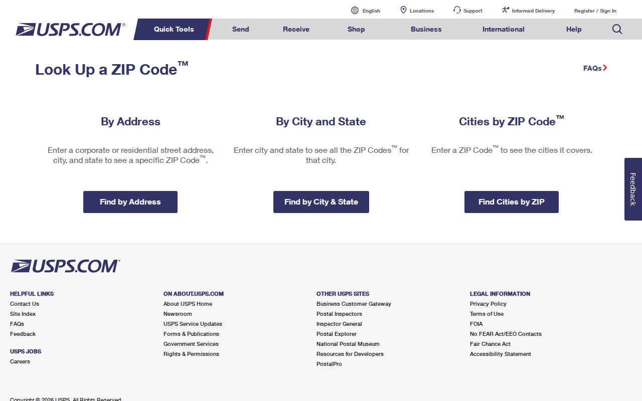
The USPS ZIP Code Lookup has three separate tasks. Use By City and State to see the postal relationship USPS recognizes for Waynesboro, Virginia. Use By Address when the street number, street, city, and state are known, adding an apartment or suite where it matters. Cities by ZIP works in the opposite direction, beginning with the postal code. The tool's own notice is important: a match does not confirm that a person or company is at that address.
| USPS mode | Inputs documented | Useful Waynesboro result |
|---|---|---|
| By Address | Company optional, street address, apartment/suite optional, city, state, ZIP optional | Tests routing for one street address or unit. |
| By City and State | City and state | Checks the recognized postal-city and ZIP relationship. |
| Cities by ZIP | ZIP | Returns the postal-city association for a ZIP already in hand. |
Preferred and recognized city names can differ, and mailing geography can cross a municipal line. Save the result with the address used, especially when a unit number changes the delivery result.
The USPS lookup screen is the official starting point for these three ZIP code tasks.
Once USPS has returned a routing result, parcel and city records answer different questions about the same Waynesboro location.
Waynesboro ZIP+4 Facility Routes
The Main Post Office and Park station share 22980 but have distinct facility suffixes: -9998 for the Main Post Office and -9997 for Park station. That is a local postal quirk, not evidence of a ZIP split. The Park station is at 422 North Commerce Avenue, and the Main Post Office is at 200 South Wayne Avenue. A request for a neighborhood, ward, or city record should not treat either suffix as a boundary.
USPS lists General Delivery and post-office box services at the Main Post Office. A post-office box or General Delivery result establishes a mail arrangement, not a household situs. For a property question, retain the physical street address and parcel details separately from the mailing address.
Waynesboro ZIP Code Record Limits
A ZIP code narrows mail geography, but the local record systems do not offer one ZIP-wide resident roll. The City Real Estate Assessor points users to ACT DataScout, though the destination returned HTTP 403 during the inspection and its current fields could not be verified. City GIS and the ward finder can confirm address geography, but no documented ZIP filter was found. The voter-list request form permits locality, district, election, and town filters, not a ZIP filter, and it is purpose-limited.
- Use USPS By City and State to confirm the current Waynesboro postal relationship.
- Run USPS By Address for the exact street number and unit when a delivery result is needed.
- Check the parcel through the assessor or GIS after the postal result, keeping situs, mailing, and city-boundary fields distinct.
- Use the Circuit Clerk or city archive only for the separate deed or transfer question, not as a ZIP-wide name search.
City property-transfer reports are arranged by month rather than a documented ZIP field. Court searches use locality, name, case number, or hearing date. State vital-record searches use event, name, date, and eligibility. Each system answers a narrower question than a ZIP code directory.
When the ZIP has narrowed an address to a street, the Waynesboro street records path is the place to compare parcel, deed, and map evidence.
Waynesboro ZIP Code and Ward Checks
Postal geography and city representation are different layers. The Waynesboro ward finder accepts an address, then directs the user to search, select the address, open the Property Sheet, and read the ward designation. That is a geographic result. It does not release a voter list or establish that a particular person lives there.
The ward finder is useful after a USPS result when a record request, city service question, or parcel review depends on city geography. The City GIS team maintains locations, named features, classifications, and addresses, with land-record, street, and aerial layers. For help when a map and a postal result seem to disagree, the GIS office is listed at 540-943-1946 and the assessor at 540-942-6722.
The official ward address workflow is shown below.
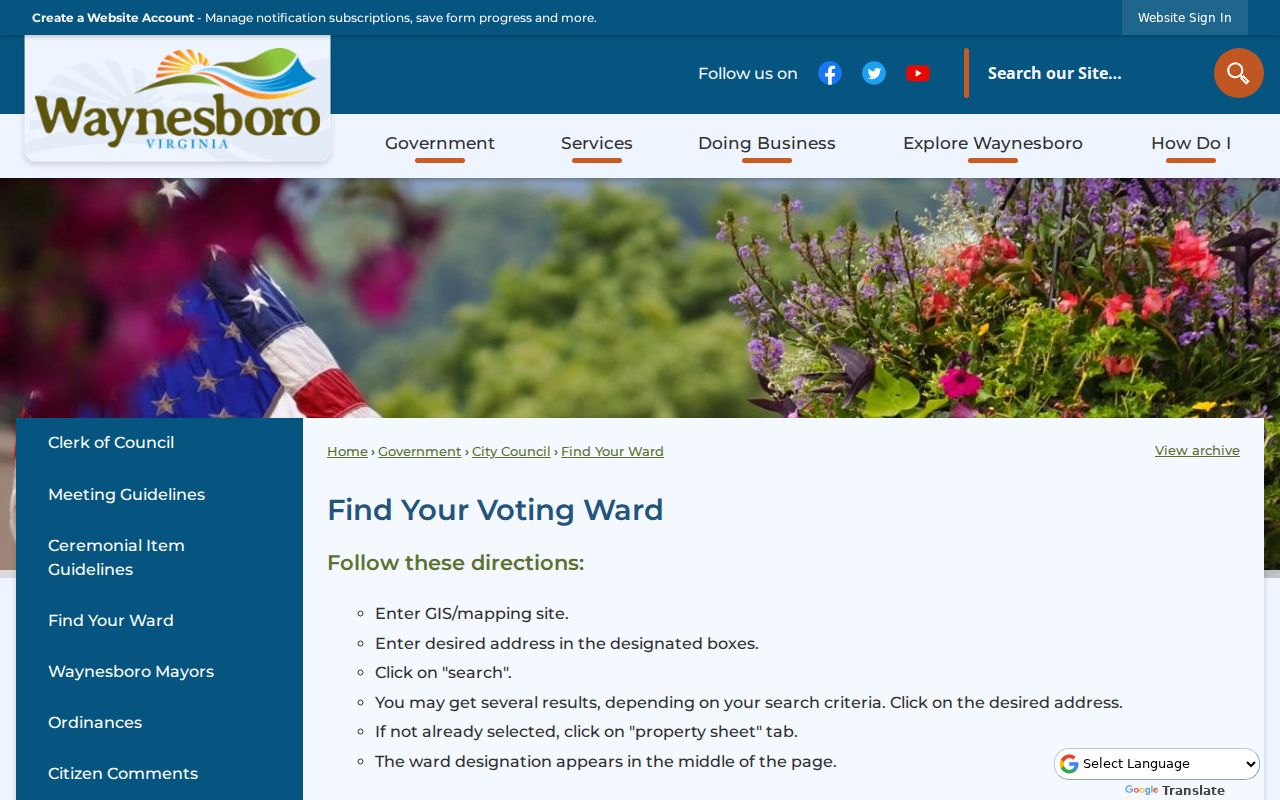
A ward result complements a Waynesboro ZIP code check, but neither one replaces the legal parcel description or a recorded deed.
Waynesboro Postal Contact Routes
Use the online USPS result first, but there are local fallbacks when the result does not settle an address question. The Main Post Office can be reached at 540-942-7320, and USPS customer service is 1-800-ASK-USPS. Ask about delivery routing, a unit, or a service question. Recheck current post-office hours before visiting. Postal staff can resolve mail-routing questions, while city offices resolve parcel and locality questions.
The City Real Estate Assessor is at 230 South Wayne Avenue and lists 540-942-6722. City GIS is also at 230 South Wayne Avenue and lists 540-943-1946. Those offices can help distinguish a situs address, parcel geometry, ward, and city geography after the postal result is known. Their role is not to issue USPS assignment decisions. The Virginia tax locality listing independently shows Waynesboro City at a 22980 mailing address, which corroborates the city-wide postal usage without defining the boundary.
A clear request names the full street address, unit if applicable, the postal result, and the specific conflict. For example, ask whether a parcel is inside the independent city or which ward applies. Do not ask a city office to infer delivery routing from a parcel map.
When USPS recognizes a city label that differs from the city line or a local description, keep both results in the address notes. Postal systems assign delivery geography, while city GIS records geographic features and parcel context. Preserving the difference prevents a mailing label from being mistaken for a jurisdiction or a record-custody decision. It also lets the right office answer the narrow question it actually keeps.
Waynesboro ZIP Code City Lines
Waynesboro is an independent city, yet its postal city and legal boundary are not the same geography. A Waynesboro postal-city address can be outside the independent-city boundary, and a city address can use a recognized postal city name under USPS addressing rules. Compare the ZIP result, locality, city boundary, and parcel field before deciding which office holds a record. Modern Waynesboro property, court, election, and tax records are city-equivalent records, not simply Augusta County records.
- ZIP code
- A postal routing code. It is not proof of city limits, a ward, a precinct, or residency.
- ZIP+4
- An added routing suffix used to direct mail more precisely. It does not create a separate public ZIP area.
- Post-office box ZIP
- A postal code associated with box delivery. It does not establish a physical household situs.
- Carrier route
- A USPS delivery sequence used for mail handling, not a municipal or property-record boundary.
Note: Keep postal, locality, parcel, and ward fields in a single address log because each may describe the same place differently.
Older Waynesboro ZIP Code Clues
No official Waynesboro ZIP realignment history was located. For an older address, use the original envelope or newspaper first, then ask USPS archival help, the local library, or an archivist whether a ZIP appeared in the year being studied. Do not add a second ZIP from a directory, post-office box, or memory without a current official USPS result.
Older records may also be filed under Basic City or Augusta County rather than the modern independent-city label. The Waynesboro Public Library holds city directories, census and newspaper microfilm, maps, and local-history material. Those sources can test an address spelling, street orientation, or historical name, even when they cannot prove a postal assignment.
The documented Sanborn editions for Waynesboro run from 1886 through 1948 and can help test the footprint, street orientation, or use of a structure. A map cannot establish an occupant or a mailing route. The verified 1950-51 Waynesboro directory citation is another address checkpoint, although it is one confirmed edition rather than a full run. Keep the postal result, map year, and directory year as separate dated entries.
Historical research is strongest when it records what is known and what remains open. A missing ZIP on an early document may simply mean the document did not use one. A current postal code should not be projected backward onto an older address without evidence from the period.